Manali to Leh Highway: The Road Trip Guide to India's Wildest Drive
By UserCarte · 5 min read
The Manali–Leh Highway is a roughly 475-kilometre mountain road across the Indian Himalaya, crossing five high passes including Tanglang La at about 5,328 metres. It is normally open from late May or June until early October, when the Border Roads Organisation clears winter snow. Most travellers split the drive over two days with a night at Jispa, Keylong or Sarchu to adjust to the altitude.
When is the best time to drive the Manali–Leh Highway?
The road's season is short and weather-dependent. Snow clearing usually finishes in late May or June, and the highway typically closes again by early to mid-October once fresh snow blocks the passes. Opening and closing dates shift every year, so check with the Border Roads Organisation, local transport operators or Himachal and Ladakh tourism channels before committing to dates.
July and August bring the warmest temperatures and the most reliable pass crossings, but they also coincide with the monsoon on the Himachal side, which means landslides, mudslides and water crossings between Manali and Keylong. June and September are the sweet spot: drier, clearer, and with genuinely startling light over the Sarchu plains. Nights at altitude drop near or below freezing in any month, so pack accordingly.
How many days do you need, and where should you stop overnight?
Do not attempt this in a single day. Even if the driving hours look manageable, gaining more than 3,000 metres of altitude in one push is the single most common cause of a ruined trip. Two days is the sensible minimum; three is better if you want to actually look at the landscape.
A classic two-day split runs Manali to Jispa or Keylong on day one — a short, easy stretch now that the Atal Tunnel bypasses Rohtang Pass — then Jispa to Leh on day two. Jispa sits beside the Bhaga River at a moderate altitude and has proper hotels and homestays, making it the best acclimatisation stop. Keylong, the administrative town of Lahaul, offers more services and fuel.
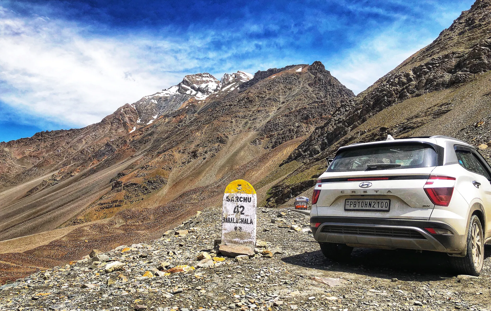
Further on, Sarchu and Pang are tented camp stops on high, exposed ground. They are atmospheric and convenient, but sleeping that high on your first night out of Manali often triggers headaches and nausea. If you have three days, consider Jispa and then Tso Kar or Rumtse instead.
What are the high passes and landmarks along the route?
The highway climbs in stages, each with its own character. After the Atal Tunnel and Lahaul valley, you pass Zing Zing Bar and Bharatpur before Baralacha La, around 4,890 metres, where glacial meltwater streams often run across the road. Sarchu marks the Himachal–Ladakh boundary.
Beyond it come the Gata Loops, a stack of twenty-one tight hairpins that lift you toward Nakee La and then Lachulung La. The descent into Pang runs through eroded sandstone canyons that look almost lunar. Then comes the highlight for many: the More Plains, a vast, flat high-altitude plateau where the road runs dead straight for tens of kilometres with mountains floating on the horizon.
The final climb is Tanglang La, one of the highest motorable passes anywhere, before the long drop through Rumtse and Upshi into the green, irrigated Indus valley and on to Leh.
Should you ride a motorcycle, drive, or take a bus?
Motorcycles are the romantic choice and the route is legendary among riders, with rental Royal Enfields widely available in Manali and Leh. Be honest about your experience: water crossings, loose gravel, broken tarmac and thin air all punish overconfidence. Ride with at least one other bike if you can.
Self-drive in a high-clearance vehicle works well, though some rental agreements restrict where you can take the car — read the terms. Hiring a local driver is the low-stress option and means someone who knows the road handles the stream crossings. Budget travellers can use the seasonal HRTC and HPTDC bus services and shared taxis, which run the route in one or two days depending on the operator.
What practical things catch first-timers out?
Fuel is the big one. Tandi, just past Keylong, has the last reliable pump before a very long gap, and the famous roadside sign there warns riders accordingly. Fill up completely and carry a jerrycan if you are on a bike with limited range.
Mobile coverage is patchy to nonexistent for long stretches, and prepaid SIMs from other Indian states generally do not work in Ladakh — postpaid connections are the workaround. Download offline maps. Carry cash, since ATMs are scarce and card machines need a signal.
Altitude sickness deserves respect: ascend slowly, drink far more water than feels necessary, skip alcohol, and discuss preventative medication with a doctor before you travel. Descending is the only real cure, so know where the nearest lower ground is. Finally, Indian nationals do not need permits for the main highway itself, but inner line permits apply to onward areas like Nubra, Pangong and Tso Moriri, and foreign nationals need a protected area permit for those. Confirm current rules locally before you go.
Tourist map: Manali to Leh Highway: The Road Trip Guide to India's Wildest Drive
- 1. Manali — open in Google Maps
- 2. Rohtang Pass — open in Google Maps
- 3. Keylong — open in Google Maps
- 4. Jispa — open in Google Maps
- 5. Baralacha La — open in Google Maps
- 6. Sarchu — open in Google Maps
- 7. Pang — open in Google Maps
- 8. Leh — open in Google Maps
Frequently asked questions
Is the Manali to Leh Highway open in May?
Sometimes, but it is not reliable. Snow clearing on the high passes usually finishes in late May or June, and the exact opening date changes every year with winter snowfall. If you are planning a May trip, keep a flexible itinerary and confirm the road's status with local operators shortly before departure.
How many days does it take to drive from Manali to Leh?
Two days is the standard and safest option, with an overnight stop at Jispa, Keylong or Sarchu. Some buses and determined drivers do it in one very long day, but the rapid altitude gain significantly raises the risk of altitude sickness. Three days allows proper acclimatisation and time for photo stops.
Do I need a permit for the Manali–Leh Highway?
Indian nationals generally do not need a permit for the main highway route itself. Permits do apply for onward restricted areas such as Nubra Valley, Pangong Tso and Tso Moriri, and foreign nationals require a protected area permit for those regions. Rules change, so verify current requirements with authorities in Leh.